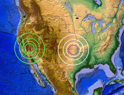
Yellowstone ALERT: 200 Earthquakes In 10 Days As Ring Of Fire Awakens

Yellowstone ALERT: 200 Earthquakes In 10 Days As Ring Of Fire Awakens:

Scientists in Yellowstone have detected over 200 earthquakes at the supervolcano in the last 10 days. With reports coming in that the Ring of Fire could be awakening as well, many are preparing for the worst.

Although scientists are still telling the public there’s no need to be alarmed, reports of immense pressure in the magma chamber under Yellowstone, coupled with this new report claiming 200 earthquakes have been recorded in the last ten days are reigniting fears of a potential supervolcano eruption. According to The Daily Mail, this latest earthquake swarm began on February 8.

Experts with the US Geological Survey say that this latest swarm began in a region roughly eight miles northeast of West Yellowstone, Montana and, it’s increased dramatically in the days since. While the earthquakes are likely caused by a combination of processes beneath the surface, the current activity is said to be “relatively weak,” and the alert level at the supervolcano remains at “normal.” The USGS says the new swarm is occurring in about the same location as the Maple Creek swarm last summer, which brought roughly 2,400 earthquakes in a four-month span.

Read moreYellowstone ALERT: 200 Earthquakes In 10 Days As Ring Of Fire Awakens

USGS: 5.9 magnitude quake shakes Oaxaca, Mexico

5.9 magnitude quake shakes Oaxaca, Mexico — USGS:

A powerful 5.9 magnitude earthquake has struck the Mexican state of Oaxaca, with shockwaves hitting the country’s capital Mexico City.

The quake rocked Oaxaca state in southwestern Mexico, according to the United States Geological Survey (USGS). The epicenter, which lay at a depth of 40km, was close to the city of Pinotepa Nacional, which has a population of 26,000.

The earthquake woke residents of Mexico City, with many people running into the streets.

This is the second quake to shake the region in the past three days. On Saturday, another powerful magnitude 7.2 earthquake hit Oaxaca state at a depth of 24.6km (15.3 miles) near the Pacific coast.

Read moreUSGS: 5.9 magnitude quake shakes Oaxaca, Mexico

10/30/2017 — VERY LARGE EARTHQUAKE (M8.4) reported in South America / Peru — USGS downgrades

10/30/2017 — VERY LARGE EARTHQUAKE (M8.4) reported in South America / Peru — USGS downgrades:

Watch the video to see the large M8.4 earthquake reported from the Russian agency:


_______

October 30, 2017

We have a mystery on our hands (yet again).

As if we are in an episode of the twilight zone, or stuck on a skipping hard drive within the matrix, yet once again we have a VERY large earthquake reported (M8.4 in the rainforests of Peru) after we issued a warning for a M7.7 to M8.7 earthquake to strike the Pacific this week.

Some people have messaged me, and are trying to say it is a “mistake”.

I suppose they mean it’s a MISQUAKE.

Read more10/30/2017 — VERY LARGE EARTHQUAKE (M8.4) reported in South America / Peru — USGS downgrades

New Study Shows Pesticide Levels Harmful to Aquatic Life in US Streams

New Study Shows Pesticide Levels Harmful to Aquatic Life in US Streams:

A new analysis published this month by U.S. Geological Survey scientists found pesticides at high enough concentrations to harm already imperiled aquatic invertebrates in more than half of 100 streams studied in the Midwest and Great Plains. The pesticide levels threaten species like the Hine’s emerald dragonfly and the sheepnose mussel.

The USGS study, published in the journal Science of the Total Environment, found an average of 54 pesticides in each stream in both agricultural and urban areas, spotlighting the ever-broadening contamination of waterways caused by the nation’s escalating use of pesticides.

Read moreNew Study Shows Pesticide Levels Harmful to Aquatic Life in US Streams

Montana Earthquake Increased “Super Volcano” Eruption Concerns

Montana Earthquake Increased “Super Volcano” Eruption Concerns:

After being hit with the strongest earthquake in 20 years, Western Montanans woke to the trembles of a 5.8 magnitude quake. Although the damage is not severe, many geological experts are now raising concerns of Yellowstone’s dormant super volcano. In the wake of this earthquake, fears have increased that it could be waking up.

The U.S. Geological Survey reported, with Reuters adding that the tremor was felt hundreds of miles away, from Missoula to Billings and some surrounding states. A swarm of over 1100 earthquakes recorded in the Yellowstone caldera over the past month, in conjunction with this recent quake in Montana has prompted scientists to voice concerns about the so far dormant Yellowstone “Supervolcano.”

Read moreMontana Earthquake Increased “Super Volcano” Eruption Concerns

Is The Yellowstone Supervolcano About To Blow? Global Food Supply Would Collapse For Two Years, Causing A Mass Die-Off Of Humans

Is the Yellowstone supervolcano about to blow? Global food supply would collapse for two years, causing a mass die-off of humans:

One of the most beautiful places in the United States that every American should visit at least once in their life is Yellowstone National Park, a vast region of wildlife and geographical wonders that stretches through parts of Wyoming, Montana and Idaho. Between the massive herds of bison that can be seen grazing out in the valleys, and the incredible geysers and hot springs that have been around for thousands of years, Yellowstone really does deserve to be one of the most popular tourist locations in the country. But despite its beauty, there is an ancient monster in Yellowstone that has remained dormant for 70,000 years… and it just might be getting ready to wake up.

Since June 12 of this year, there have been over 400 earthquakes recorded in Yellowstone, the latest being a magnitude 3 earthquake that struck on Monday, June 19. Just four days earlier, Yellowstone was hit with an even larger, magnitude 4.5 earthquake. “The epicenter of the shock was located in Yellowstone National Park, eight miles north-northeast of the town of West Yellowstone, Montana,” said scientists from the University of Utah in a statement. “The earthquake was reportedly felt in the towns of West Yellowstone and Gardiner, Montana, in Yellowstone National Park, and elsewhere in the surrounding region.” (Related: Scientists have been underestimating the threat of earthquakes.)

Read moreIs The Yellowstone Supervolcano About To Blow? Global Food Supply Would Collapse For Two Years, Causing A Mass Die-Off Of Humans

The Earth’s Crust Will Be Shaken By More Than 100,000 Earthquakes That Humans Can Feel In 2016

Earth-From-Space

The Earth’s Crust Will Be Shaken By More Than 100,000 Earthquakes That Humans Can Feel In 2016:

Did you know that our planet will be hit by more than 100,000 earthquakes of magnitude 3.0 or greater this year alone?  Earlier today, I came across a report that contained this amazing fact, but it was so incredible that I felt that I had to go and verify it myself.  So I went to the official USGS website, and I found out that this is actually true.  Overall, there are about half a million earthquakes around the globe each year, but it is only when a quake is of about magnitude 3.0 or greater that humans actually feel them.  As the very large earthquakes in Italy and Myanmar within the last 24 hours have demonstrated, the shaking of our planet is getting worse, and this is something that I have written about over and over again.  So why is this happening?  Why does the crust of our planet seemingly become more and more unstable with each passing year?

Read moreThe Earth’s Crust Will Be Shaken By More Than 100,000 Earthquakes That Humans Can Feel In 2016

USGS Climatologist: Nibiru (Planet X, Nemesis, Tyche, Wormwood, Hercolubus) Will Ravage The Earth

hercolobus

Nibiru Will Ravage The Earth : USGS Climatologist:

As Nibiru draws near, the number of whistle-blowers willing to break silence seems to have grown exponentially, despite hazards to their safety. A former United States Geological Survey (USGS) climatologist, Dr. Ethan Trowbridge, joins the growing list of brave men and women who have broken vows of silence and violated non-disclosure agreements to speak out against the most diabolical cover-up in human history.

Dr. Trowbridge earned his degree at Iowa State University. His credentials include fourteen years’ employment at the USGS, a government sponsored scientific agency which studies the Earth’s landscape, its natural resources and, most importantly, natural hazards that threaten it. The USGS is run by the Department of the Interior; it is that department’s sole scientific branch. Its duties include cataloging and analyzing earth changes associated with gradual and drastic climate change. During his tenure with this often misunderstood agency, Dr. Trowbridge supervised its geomagnetism program and core sciences division. He also learned about a celestial danger often called Nibiru, a term linked to a solar system consisting of a brown dwarf star and seven orbiting planets.

Read moreUSGS Climatologist: Nibiru (Planet X, Nemesis, Tyche, Wormwood, Hercolubus) Will Ravage The Earth

Federal Lab Ignored Environmental Data Manipulation For YEARS

Federal Lab Ignored Environmental Data Manipulation For YEARS:

U.S. Geological Survey (USGS) officials knew about environmental data manipulation for years before they stopped the manipulation or notified scientists who may have used phony information, a Daily Caller News Foundation investigation has found.

A USGS analyst resigned while under investigation for data manipulation from 1996 to 2008, but another analyst continued that distortion until 2014. But agency officials learned data was manipulated as early as 2004 when scientists found “test results did not make sense” and “were not accurate,” according to a Department of the Interior inspector general (IG) audit published 11 years later.

Read moreFederal Lab Ignored Environmental Data Manipulation For YEARS

New York Times Afghanistan And Pakistan Hit By Huge Earthquake

Afghanistan and Pakistan Hit by Huge Earthquake:

KABUL, Afghanistan — A deadly earthquake hit northern Afghanistan and Pakistan on Monday afternoon, registering a preliminary magnitude of 7.5 and causing heavy damage in one of the world’s most impoverished and war-torn regions.

At least 122 people were reported killed, with 100 or more of them in Pakistan, and that figure seemed likely to rise significantly, officials in both countries said.

Read moreNew York Times Afghanistan And Pakistan Hit By Huge Earthquake

USGS: Technical Announcement: Widely Used Herbicide Commonly Found in Rain and Streams in the Mississippi River Basin

Related info:

Gov. Study: Roundup Weedkiller Found In 75% of Air And Rain Samples

More info down below.


Roundup-08

Technical Announcement: Widely Used Herbicide Commonly Found in Rain and Streams in the Mississippi River Basin (USGS, Aug 29, 2011):

Glyphosate, also known by its tradename Roundup, is commonly found in rain and rivers in agricultural areas in the Mississippi River watershed, according to two new USGS studies released this month.

Glyphosate is used in almost all agricultural and urban areas of the United States. The greatest glyphosate use is in the Mississippi River basin, where most applications are for weed control on genetically-modified corn, soybeans and cotton. Overall, agricultural use of glyphosate has increased from less than 11,000 tons in 1992 to more than 88,000 tons in 2007.

Weedkiller Glyphosate for GM Crops Pollutes Air, Rain and Rivers across America (Global Research, Aug  31, 2011):

Two new studies by the U.S. Geological Survey reveal the pervasive spread of the biocide, glyphosate, mostly used as a weedkiller for crops genetically engineered to resist it.

Used in formulations by Monsanto, Bayer, Dow and others, glyphosate has, according to several reports, been linked to spontaneous abortions in livestock, birth defects in humans, insect resistance, and weed resistance.

Worse, regulators have known for years of these links, Earth Open Source reported.

In early August, Dr. Mercola reported: 

Read moreUSGS: Technical Announcement: Widely Used Herbicide Commonly Found in Rain and Streams in the Mississippi River Basin

West Coast LARGE Earthquake Warning — USGS quote “any day now” — 7/23/2015 — (Video)

Don’t miss!

Related info:

Huge Earthquake To Devastate Pacific Northwest (Video):

It will strike, and it will be bigger than the 9.0 that struck Japan in 2011.

“Our operating assumption is that everything west of Interstate 5 will be toast,” says Kenneth Murphy, who directs FEMA’s Region X, the division responsible for Oregon, Washington, Idaho, and Alaska

“The region will be unrecognizable …. That’s Seattle, Tacoma, Portland, Eugene, Salem (the capital city of Oregon), Olympia (the capital of Washington), and some seven million people.”

FEMA expects that nearly thirteen thousand people will die in the earthquake and ensuing tsunami. Another twenty-seven thousand will be injured. On top of that, the agency expects that “it will need to provide shelter for a million displaced people, and food and water for another two and a half million.”


Jul 23, 2015

Description:

Warning issued for a large earthquake to strike the West coast near San Francisco California (quote) “Any day now” comes from professionals:

http://sanfrancisco.cbslocal.com/2015…
______

New Yorker article calling for a M9.2 earthquake along the West coast in the near term future:

http://www.newyorker.com/magazine/201…

________

TV News ticker accidentally shows M9.0 “mega-quake” announcement for San Francisco California on live TV:

https://www.youtube.com/watch?v=xpQAx…

Read moreWest Coast LARGE Earthquake Warning — USGS quote “any day now” — 7/23/2015 — (Video)

Two Earthquakes 1,000 miles apart– RELATED?! — California Volcano + Oklahoma Fracking (6/29/2015)

H/t reader squodgy:

“This might be worth keeping an eye on. If dormant volcanoes are rumbling in sympathy with fracking quakes several states away, it could be linked to the Craton Plate becoming more unhinged.”


6/29/2015 — Two Earthquakes 1,000 miles apart– RELATED?! — California Volcano + Oklahoma Fracking (Dutchsinse, June 29, 2015):

Two earthquakes occurred virtually back to back from one another across 1,000 miles — one in California (at a dormant volcano), and the other in Oklahoma (at a fracking operation).

I believe these events are related.  I will explain more below the graphic.

earthquake-36N-latitude-june-29-2015
Above: Two “back to back” earthquakes struck in the United States , both in the M3.0 range (3.2+3.4) occurring approximately 1075 miles apart.

________

[disclaimer:USGS says small earthquakes are NOT related to each other over large distances, this obviously needs to change, and is an incorrect assumption on their part]

________

If you look at the above graphic, which shows the earthquakes plotted via USGS coordinates, you will clearly see that both earthquakes almost fall on a direct “line” between one another.

Read moreTwo Earthquakes 1,000 miles apart– RELATED?! — California Volcano + Oklahoma Fracking (6/29/2015)

US mid-continent seismicity linked to high-rate injection wells

H/t reader squodgy:

“Could all this hype be the escape route for an industry being devastated by Saud led oil prices?

They conveniently ignore all the damage to properties over the years, or gas from faucets, or poisoned water, so now they are unviable they need an escape plan.”


cu-boulder_injection_welling_research_f_2015

US mid-continent seismicity linked to high-rate injection wells (The Watchers, June 19, 2015):

A dramatic increase in the rate of earthquakes in the central and eastern US since 2009 is associated with fluid injection wells used in oil and gas development, says a new study by the University of Colorado Boulder and the USGS.

The number of earthquakes associated with injection wells has skyrocketed from a handful per year in the 1970s to more than 650 in 2014, according to CU-Boulder doctoral student Matthew Weingarten, who led the new study.

The increase included several damaging quakes in 2011 and 2012 ranging between magnitudes 4.7 and 5.6 in Prague, Oklahoma; Trinidad, Colorado; Timpson, Texas; and Guy, Arkansas.

“This is the first study to look at correlations between injection wells and earthquakes on a broad, nearly national scale,” said Weingarten of CU-Boulder’s geological sciences department. “We saw an enormous increase in earthquakes associated with these high-rate injection wells, especially since 2009, and we think the evidence is convincing that the earthquakes we are seeing near injection sites are induced by oil and gas activity.”

The researchers found that “high-rate” injection wells – those pumping more than 300 000 barrels of wastewater a month into the ground – were much more likely to be associated with earthquakes than lower-rate injection wells. Injections are conducted either for enhanced oil recovery, which involves the pumping of fluid into depleted oil reservoirs to increase oil production, or for the disposal of salty fluids produced by oil and gas activity, said Weingarten.

Read moreUS mid-continent seismicity linked to high-rate injection wells

West Coast US Eruption? Mt. Hood Volcano In Oregon Sends Signals Of Activity – USGS Installing New Equipment

H/t reader squodgy:

“To take our minds off Fukushima, the Economy & WWlll, here’s another….”


3/19/2015 — West coast US eruption? Mt. Hood Volcano in Oregon sends signals of activity — USGS installing new equipment (DutchSinse, March 19, 2015):

USGS installing new CO2 (carbon dioxide) gas monitoring equipment on Mount Hood Volcano in Oregon.  ( the equipment also can measure SO2 / sulfur dioxide).


Screenshot below from Google Earth shows Mount Hood in the foreground, and the multiple other large volcanic peaks located due North.

Just across the border from Oregon’s Mt. Hood, resides the much more famous Mount St. Helens.

mount-hood-oregon-volcano-march-18-2015

As seen in the above screenshot, Mount St. Helens, Mount Rainier, and Mount Adams, as well as West Crater, and Indian Heaven all are within a very short distance from Mount Hood.

Read moreWest Coast US Eruption? Mt. Hood Volcano In Oregon Sends Signals Of Activity – USGS Installing New Equipment

Leaked Email: USGS Yellowstone Supervolcano (Video)


Feb 19, 2014

This Email sent out explains all the preparations in Fema Region Three and all the supplies being moved to the East Coast. Fema Coffins and all the Military Build Up preparing for Gun confiscations and Martial Law.
What would Happen If Yellowstone Erupted.
http://www.youtube.com/watch?v=q14nrq…
Yellowstone in the Mainstream January 7th 2014 Hmmm…
http://www.youtube.com/watch?v=9tUe3X…
Very Interesting Link from the ATS Forum.
http://www.abovetopsecret.com/forum/t…
More Links
http://strangesounds.org/2014/02/is-y…

http://www.examiner.com/article/super…

USGS Confirms Oklahoma Quakes Are Due To Fracking

USGS Confirms Oklahoma Quakes Are Due To Fracking (ZeroHedge, Feb 21, 2015):

The debate about the cause of the exponential rise in the frequency of earthquakes in Oklahoma has really heated up in the last year, but as KFOR4 reports, The United States Geological Survey (USGS) appears to have put any doubt firmly to rest. In a strongly-worded press release, the USGS states, “…Large areas of the United States that used to experience few or no earthquakes have, in recent years, experienced a remarkable increase in earthquake activity.. This rise in seismic activity, especially in the central United States, is not the result of natural processes... Instead, the increased seismicity is due to fluid injection associated with new technologies that enable the extraction of oil and gas from previously unproductive reservoirs.” For some, that could end the debate; but Kim Hatfield, with the Oklahoma Independent Petroleum Association, is not so sure, “I don’t think it’s particularly helpful because basically, it says we’ve come to a conclusion, but we don’t have the science to back it up.”

Full USGS Statement: Coping with Earthquakes Induced by Fluid Injection

Read moreUSGS Confirms Oklahoma Quakes Are Due To Fracking

USGS Reports 6.8 Magnitude Earthquake In Russia Near Ukraine Border, Then Retracts It Blaming “Mislocation”

USGS Reports 6.8 Magnitude Earthquake In Russia Near Ukraine Border, Then Retracts It Blaming “Mislocation”

Something surprising happened about an hour ago: at 2:15 pm, the USGS reported that a major 6.8 Magnitude earthquake had taken place in Russian territory, 16 kilometers WNW of Klintsy, in a location that is close to the Russian border with both Belarus and Ukraine. What is curious is that some 20 minutes later, the USGS decided that no quake had actually taken place. In fact not only was the earthquake promptly scrubbed from the USGS website but the link we had sent out as notification of the earthquake.

Largest Kansas Earthquake In 140+ Years – 4.4M Strikes FRACKING Operation (Video)


Oct 2, 2014

Full post with screenshot proof of the nearest frack well here:

http://dutchsinse.tatoott1009.com/100…

More info on fracking:

Just 4 Fracking Wastewater Sites Cause 20% Of All Central US Earthquakes

Will Fracking Cause Our Next Nuclear Disaster?

Read moreLargest Kansas Earthquake In 140+ Years – 4.4M Strikes FRACKING Operation (Video)

EARTHQUAKES: Mag 6.6 Valparaiso, Chile, Mag. 5.3 Iceland (Video)


Aug 23, 2014

Mag. 6.6 Valparaiso, Chile and Mag. 5.3 Hofn, Iceland….

Website: sott.net
Source credit: USA Today, USGS
Map credit: USGS
Photography credit: belongs to their respective owner(s) and not to me..
Article Links:
http://www.sott.net/article/284340-6-…
http://www.sott.net/article/284341-US…

Original website, article link: USATODAY
http://www.usatoday.com/story/news/wo…

San Francisco Bay Area Hit By Strongest Earthquake In 25 Years; Wine Country Shakes (Photos & Videos)

San Francisco Bay Area Hit By Strongest Earthquake In 25 Years; Wine Country Shakes – LIve Webcast (ZeroHedge; Aug 24, 2014):

First a drought, then a plague, now an earthquake: if these three aren’t enough to help boost California’s GDP, then it may be time for Krugman to resign. Oh and prepare for wine prices to become the latest participant in Janet Yellen’s inflationary “noise” parade. The reason – images such as this one showing what happens when a powerful quake hits just miles away from San Francisco’s wine area.

The red stuff is luckily not blood:

As Reuters reports, and as thousands felt early this morning, an earthquake of 6.0 magnitude, the largest in the region for 25 years, shook the San Francisco Bay Area early on Sunday, waking residents and causing some power outages and minor damage, according to initial reports. NBC Bay Area reports that The Queen of the Valley Hospital in Napa has admitted 70 patients but their injuries are not expected to be serious. An office building in Napa was dechunked.A video from the quake in progress:

The U.S. Geological Survey (USGS) said the epicenter of the quake was eight km (five miles) northwest of the town of American Canyon, on the northern edge of the Bay, hitting some 9 kilometers away from the city of Napa at a depth of 10.8 kilometers. Latest shake map below.

Read moreSan Francisco Bay Area Hit By Strongest Earthquake In 25 Years; Wine Country Shakes (Photos & Videos)

USGS: 1 Day, Magnitude 2.5+ Worldwide – 39 Earthquakes!

1 Day, Magnitude 2.5+ Worldwide (USGS, June 29, 2014):

39 earthquakes

Updated: 2014-06-29 21:17:43 UTC+00:00

Showing event times using Local System Time

(UTC+00:00)

  1. 2.5 16km NE of Hawaiian Ocean View, Hawaii 2014-06-29 19:22:30 UTC+00:00 1.4 km
  2. 5.6 193km WNW of Hihifo, Tonga 2014-06-29 18:24:30 UTC+00:00 10.0 km
  3. 3.1 79km NNW of Kobuk, Alaska 2014-06-29 17:43:24 UTC+00:00 15.2 km
  4. 5.1 165km NNW of Visokoi Island, 2014-06-29 17:33:54 UTC+00:00 10.0 km
  5. 4.0 101km NNW of Kobuk, Alaska 2014-06-29 17:33:41 UTC+00:00 11.7 km
  6. 5.2 9km NE of Zaqatala, Azerbaijan 2014-06-29 17:26:12 UTC+00:00 34.4 km
  7. 6.7 205km SSE of Mata-Utu, Wallis and Futuna 2014-06-29 17:15:08 UTC+00:00 10.0 km
  8. 6.4 197km NW of Hihifo, Tonga 2014-06-29 15:52:22 UTC+00:00 10.0 km
  9. Read moreUSGS: 1 Day, Magnitude 2.5+ Worldwide – 39 Earthquakes!

Questions Persist About Yellowstone Eruption: Is US Evacuation Plan In Place?

Related info:

Yellowstone Earthquake Swarm Close To Multiple 4.0 Supervolcano Eruption (Video)


Questions persist about Yellowstone eruption: Is US evacuation plan in place? (Examiner, June 2, 2014):

The earth around the Yellowstone supervolcano is increasingly becoming seismically active. Some scientists say it is not a matter of “if” the Yellowstone supervolcano will erupt, but rather “when” it will erupt.

And so, questions persist about a “worst-case scenario” Yellowstone supervolcano eruption:

Read moreQuestions Persist About Yellowstone Eruption: Is US Evacuation Plan In Place?