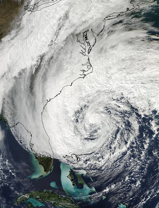
– In Advance Of Frankenstorm Sandy, NYC Suspending All Transit Services At 7:00 PM Sunday (ZeroHedge, Oct 28, 2012):
It seems like it was only yesterday that the panic ahead of Hurricane Irene, which was a light breeze by the time it hit NYC, was being spread by various government agencies and every possible media. It is deja vu time, and moments ago, in order to be “fully prepared” ahead of Frankenstorm Sandy, NY governor Cuomo just announced that at 7:00 pm tonight, the New York Metropolitan Transit Authority, i..e., subways, buses and trains, is suspending all service at 7:00 pm (and 1,100 national guards are being activated). This also means that tomorrow Wall Street will be a complete ghost town as everyone takes a day off, and the algos will be the only ones in charge (more or less as usual).
And an update on what is actually happening from the Wunderground blog:
Sandy’s tropical storm-force winds now extend 450 nautical miles from the center on the northeast side of the hurricane. This is a very, very large storm, and I suspect the #1 spot (Olga of 2001) is in jeopardy, as well.
Top 12 Largest Atlantic Tropical Cyclones
These sizes were determined using the Extended Best Track dataset (Demuth et. al 2006).
Name, Year: Radius of tropical storm-force winds (nautical miles)
1. Olga, 2001: 600
2. Lili, 1996, 450
2. Sandy, 2012: 450
3. Tanya 1995: 400
3. Irene 1999: 400
3. Igor, 2010: 400
4. Wilma, 2005: 375
5. Felix, 1995: 360
5. Michael, 2000 360
5. Irene, 2005: 360
5. Irene, 2005 360
5. Florence, 2006: 360

High resolution MODIS visible satellite image of Hurricane Sandy on October 27, 2012.